
Satellite Images Reveal an Unusual Opening in the Great Atlantic Sargassum Belt
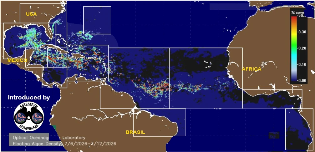
Figure 1. Before the opening formed, the Great Atlantic Sargassum Belt displayed a relatively continuous structure.
The latest analyses conducted by Sargassum Monitoring have identified an unusual development within the Great Atlantic Sargassum Belt.
By comparing satellite images collected over recent weeks, we observed that a large opening began to form between July 9 and July 15, 2026. Since then, this area—where the concentration of sargassum is significantly lower—has remained visible and continues to be closely monitored.
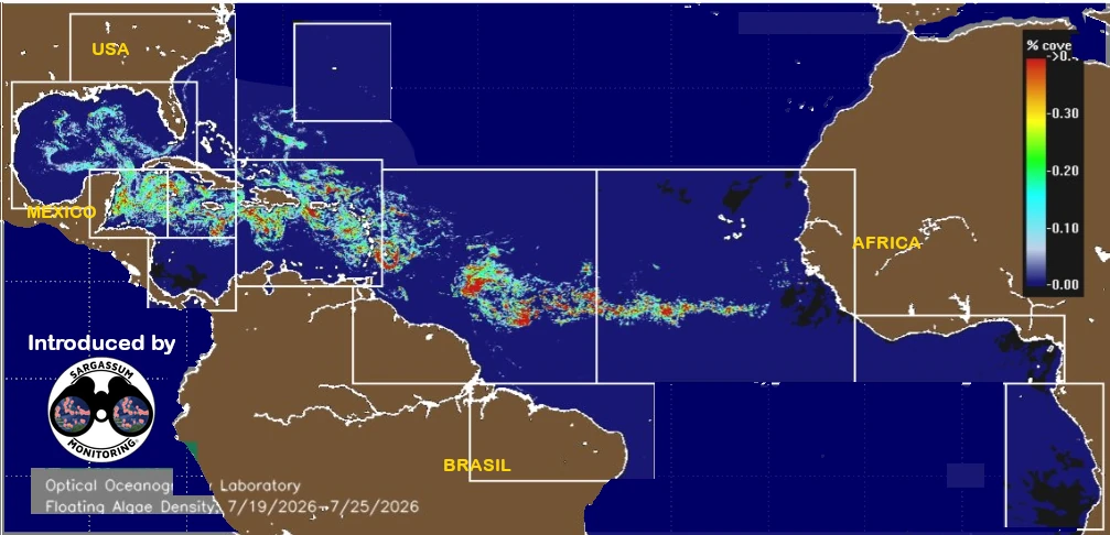
Figure 2. The first signs of the opening became visible in satellite imagery between July 9 and July 15, 2026.
The Great Atlantic Sargassum Belt normally stretches for thousands of kilometers between the west coast of Africa and the Caribbean. It is the primary source of the massive sargassum beach landings that affect many coastlines across the tropical Atlantic each year.
At this stage, it is still too early to determine what caused this opening or whether it is only temporary. Winds, ocean currents, and weather conditions constantly influence the distribution of floating sargassum across the Atlantic Ocean.
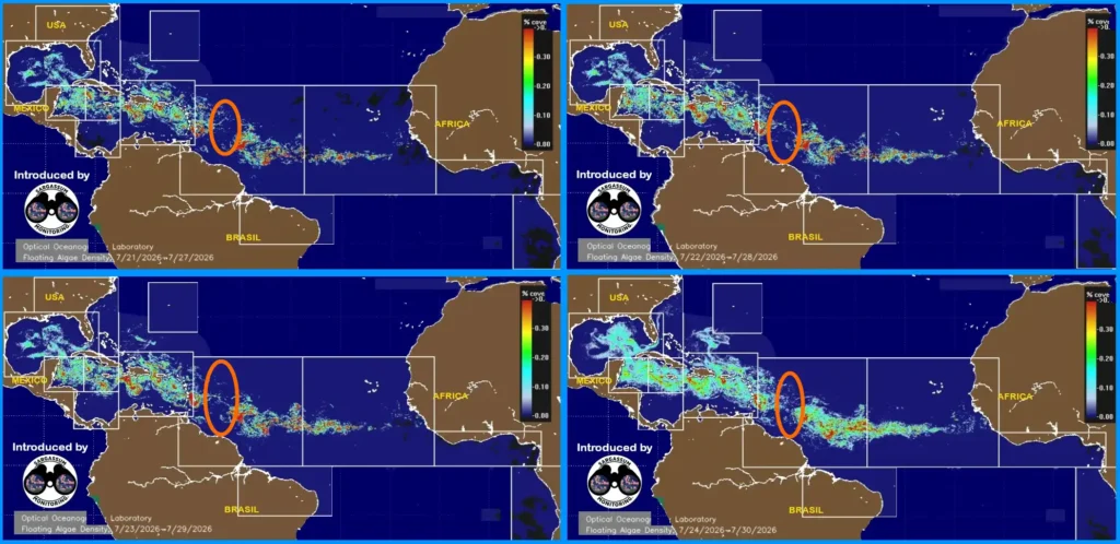
Figure 3. Satellite images show the gradual expansion of the opening during the second half of July 2026.
This development does not mean that the sargassum season is over. Large quantities of sargassum are still present across the Atlantic, and new beach landings remain possible in the coming weeks.
The satellite images below illustrate how this opening gradually developed over time. They also highlight the importance of continuous satellite monitoring in understanding the evolution of the Great Atlantic Sargassum Belt.
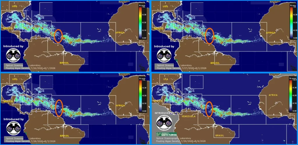
Figure 4. At the beginning of August 2026, the opening remains clearly visible and continues to be monitored on a daily basis.
Satellite images provide a broad view of the ocean, but they cannot, by themselves, show the real conditions on every beach. That’s why field observations are essential.
Fotos/photos – Source/Fuente : USF – SaWS
Your Help Matters
Situations like this clearly demonstrate why field observations are so important.
If you live in—or are visiting—an affected region, your photos and reports help compare what satellites observe from space with actual conditions on the beaches. Together, these observations help us monitor this apparent lull, assess how long it lasts, and better understand its possible impact on future sargassum landings.
Since 2018, thousands of volunteers have contributed to this international monitoring effort. Every geolocated photo—even when no sargassum is present—provides valuable information.
You can contribute today by sharing your observations on the official Sargassum Monitoring map.