
Winds that drive the Sargassum
Live Atlantic Wind Map – Understanding Sargassum Movement
Source: earth.nullschool.net
The Great Atlantic Sargassum Belt is carried westward by ocean currents, including the Gulf Stream system, while winds — particularly the trade winds — influence its movement and direction toward the Caribbean and surrounding regions.
Map provided by SIMAR Sargassum SATSUM- CONABIO – (10-Day Outlook)
Sargassum arrivals in Atlantic – Caribbean Sea – Gulf of Mexico can vary significantly depending on ocean currents, wind conditions, sea state and the distribution of floating sargassum across the Caribbean.
Our sargassum monitoring information helps identify areas where significant amounts of floating sargassum are present offshore and where coastal areas may potentially be affected. These observations provide an early indication of possible sargassum arrivals and can support preparation and coastal management.
Because ocean conditions can change rapidly, a sargassum forecast should be understood as an indication of potential coastal impact rather than an exact prediction of when and where sargassum will reach a specific beach.

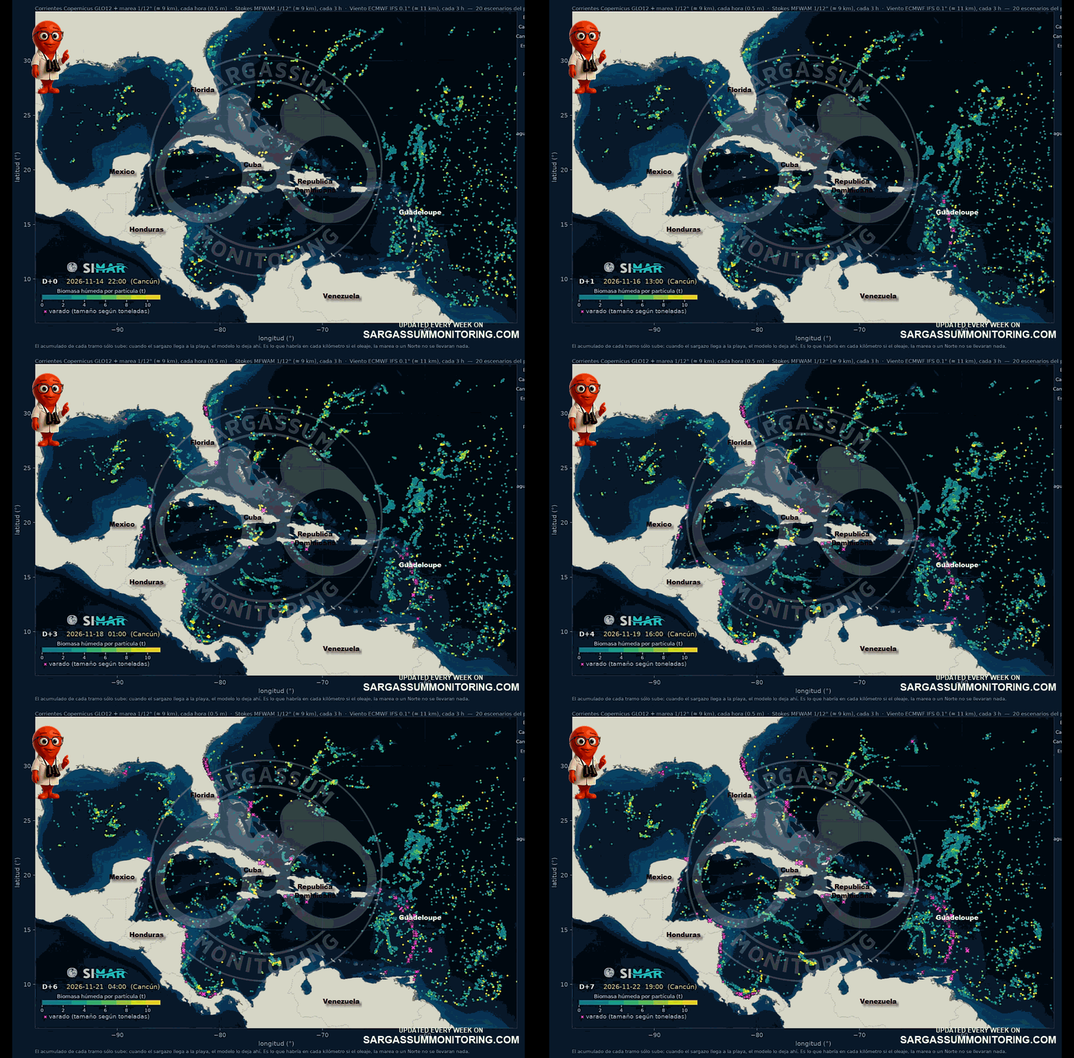
Updated on November 16, 2026
Latest Map from USF – SaWS
Legend of the USF-SaWS Map :
Images are an interpretation of satellite images.
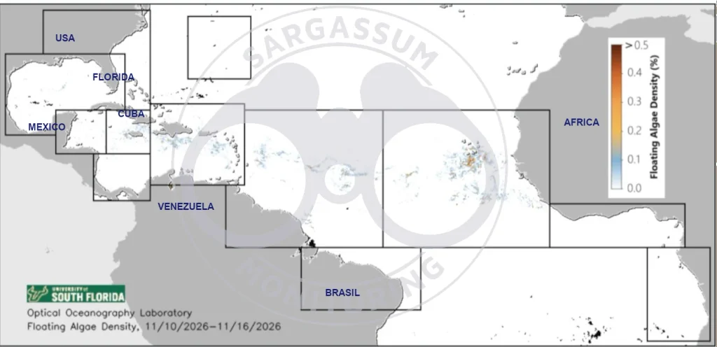
Updated on November 17, 2026