Punta Cana – Bayahibe – Isla Saona – Samana – Cap Cana – Haiti
Map provided by CARICOOS
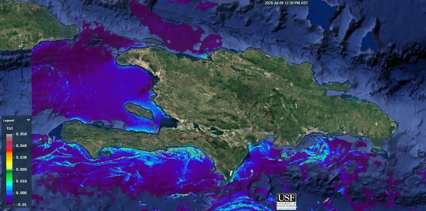
Updated on July 10, 2026

CARICOOS is the regional association for the coastal and ocean observing system for Puerto Rico and the U.S.
Map provided by the Dominican Government and ANAMAR
Map validity date: June 30 to July 05, 2026
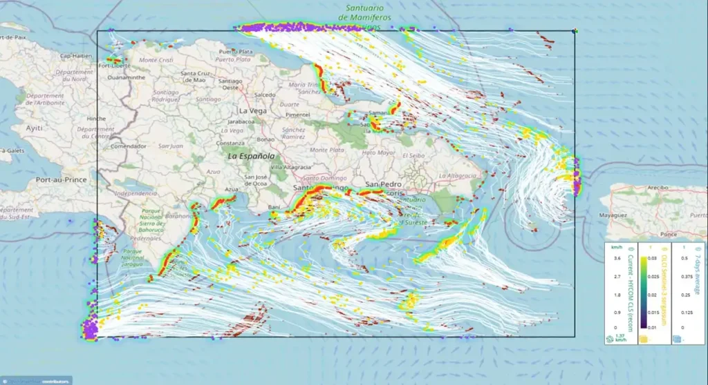
Updated on July 02, 2026
Notes:
– CLS – SAMtool / Sargassum trajectory forecast, Dominican Republic area.
– The image is shown “as is”, with no guarantee of reliability or quality for your particular use.
– Cloud cover interferes with sargassum detection.
– Sargassum is not detected within 1 km of the coast.
The white lines represent the trajectory of the sargassum from the point of origin to the end point (5-day period).