Sargassum arrivals in Florida can vary significantly depending on ocean currents, wind conditions, sea state and the distribution of floating sargassum across the Caribbean.
Our sargassum monitoring information helps identify areas where significant amounts of floating sargassum are present offshore and where coastal areas may potentially be affected. These observations provide an early indication of possible sargassum arrivals and can support preparation and coastal management.
Because ocean conditions can change rapidly, a sargassum forecast should be understood as an indication of potential coastal impact rather than an exact prediction of when and where sargassum will reach a specific beach.
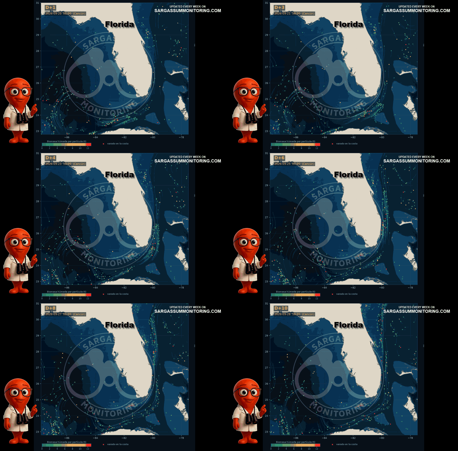
Map provided by SIMAR Sargassum SATSUM- CONABIO – (10-Day Outlook)
Updated on September 21, 2026
How are Sargassum stranding forecasts calculated ?
Sargassum movement forecasting method :
Each red dot corresponds to a sargassum patch identified by the “AFAI” thanks to satellites. The sargassum layer is influenced by environmental conditions in the area, such as currents and winds. Based on current forecasts from “HYCOM” and wind forecasts from “NCEP”, it is possible to estimate the trajectory of the sargassum and its possible arrival along Caribbean beaches.
The image in this animation corresponds to 7 days, as you can see from the dates at the top of the image.
These forecasts give a general indication, but their reliability is limited to current knowledge of sargassum.

Updated on September 18, 2026
Sargassum trajectories – Diffusion + currents (HYCOM) + windage (NCEP)
This information is provided by the Mexican government.